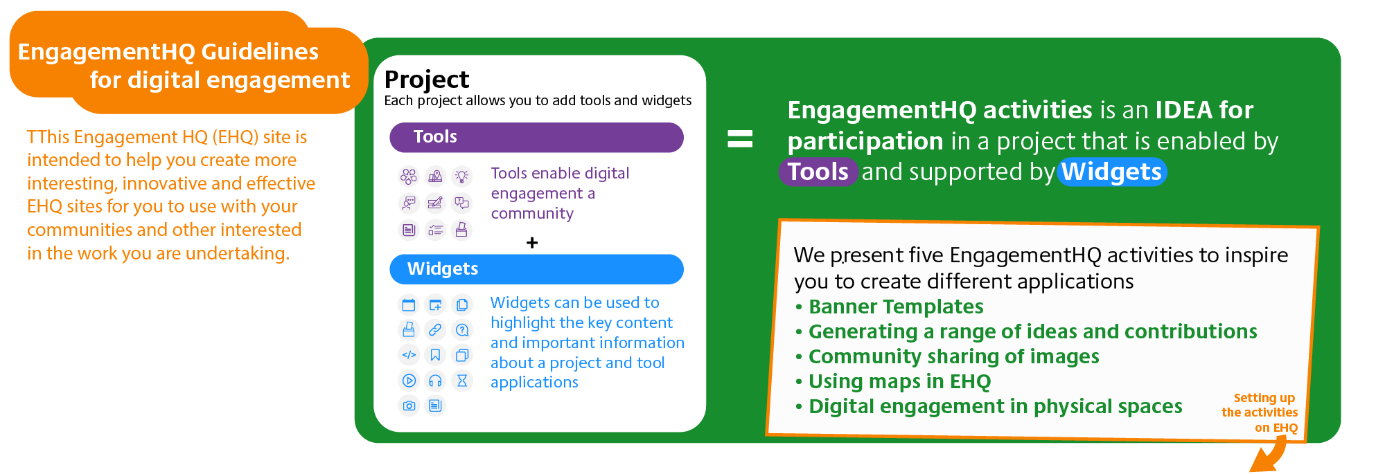
Using Maps in Engagement HQ
Description
Engagament HQ can use maps to enable people to place a comment, information or other 'objects' on a map. The map can be any scale you want from the world to a specific neighbourhood. We achieve this through the ''Places' tool. It can be used for enabling a community, for example, to share impromptu community organised events, to map out historical landmarks in an area, or to map places where and when people are fly-tipping in an area.
The film below shows how community members can use maps to share ideas or information
EngagementHQ setup (example)
Watch these steps on the video below
Summary: Setting up a map activity in Engagement HQ
- Add the tool “Places” to a project.
- Type a prompt to encourage residents to share the history of Mainway
- Set Mainway as location
- Draw a boundary to limit the interaction to the Mainway area
- Add a pin and select a monument or information icon
- Add a dropdown question with years from 1960 to 2021
Share Using Maps in Engagement HQ on Facebook
Share Using Maps in Engagement HQ on Twitter
Share Using Maps in Engagement HQ on Linkedin
Email Using Maps in Engagement HQ link
